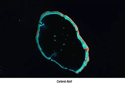
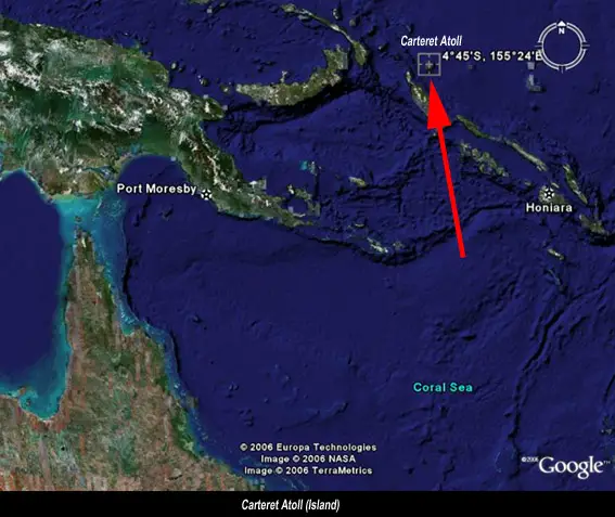
Carteret Atoll, also known as The Carteret Islands are part of Papua New Guinea located 86 kilometres northeast of Bougainville in the South Pacific at 4°45’S, 155°24’E. Carteret Atoll incorporates a scattering of low lying islands in a horseshoe shape stretching around 30 kilometers in north-south direction, with a total land area of 0.6 square kilometers and a maximum elevation of 1.5 meters above sea level.
The islands were named after the British navigator Philip Carteret who discovered them in the sloop Swallow in 1767. In 1896 a Samoan-American woman, known locally as ‘Queen’ Emma Coe, bought the island for four axes and 4.5 kg of tobacco. Under Imperial German protection, she had all the trees chopped down and replaced with coconuts, and she imported Papua New Guineans from New Ireland to work the plantations.
As of 2005 about one thousand people live on the islands. Han is the most significant island with partial (but rapidly dying due to saltwater introgression) tree cover, the others being small islets in the lagoon.
Sea Level Monitoring
Australia’s National Tidal Facility, a specialist centre based in Adelaide, has for the past decade monitored sea-level changes across the Pacific, but said it does not have enough long range data to explain what might be occuring with certainty. Their tide-measuring station on Papua New Guinea’s Manus Island, 1,100 km west of the atolls, has measured an annual 8.2 mm rise in sea-levels over the past seven years.
The Solomon Islands station, 750 km to the south, has recorded an annual 6.2 mm rise over the past eight years. Nauru, 1200 km northeast, has recorded 5.6 mm per year over nine years.
The area is at a junction of the Australasian-Indian tectonic plates, which produce a large number of major earthquakes. Some experts believe the quakes are responsible for the sinking of some islands and the rising of others.
Evacuation
It was widely reported that the islands have progressively become uninhabitable, with an estimate of their total submersion by 2020. The islanders have fought for more than twenty years against the rising ocean, building sea walls and planting mangroves. However, storm surges and high tides continue to wash away homes, destroy vegetable gardens and contaminate fresh water supplies. On November 24, 2005, the Papua New Guinean government authorised the government funded total evacuation of the islands. It has been estimated that by 2015, Carteret Atoll will be largely submerged and entirely uninhabitable.
Tuvalu, and Majuro are other small nations in the South Pacific which are likely to be evacuated in time to come.